For the past six weeks, I have been somewhat distracted from my normal PhD research routine. My passion for rock and mineral mapping has been replaced by a strong interest in satellite bushfire scar mapping. My interest is personal, stemming from the fact that my family and I live on Kangaroo Island, and we have observed the devasting environmental, economic, and social effects that the bushfires have had on our local community. I am hoping that by posting my latest bushfire mapping efforts, this relatively new information may be of assistance to the island community…whether it be for land management, habitat assessment, fire prevention, or just so folks can have a better understanding of the distribution of burnt areas across the island.
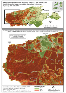
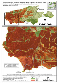
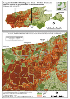
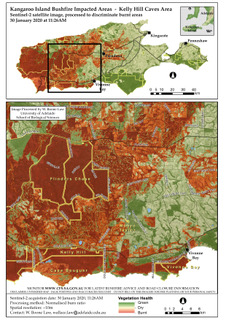
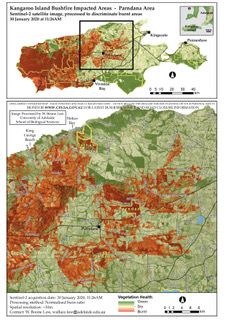
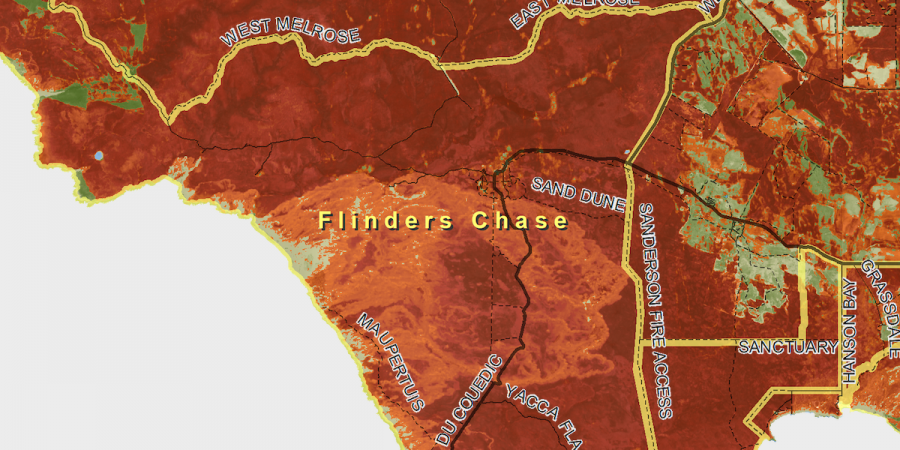
The five A4-sized maps offered below discriminate the burnt areas of Kangaroo Island, based on imagery collected by the Sentinel-2 satellite on 30 January 2020 at 11:26AM. I have purposely made the maps with significant overlapping areas of the island, so users may be able observe large areas without the need to patch the maps together like a jigsaw puzzle. I have named the maps after five prominent areas of the island: 1) Cape DeCouedic, 2) Kelly Hill Caves 3) Cape Borda, 4) Western River, and 5) Parndana. The location of each of these areas is easily identified in the key at the top of each page in the PDF.
The maps are produced using a customised variant of a common remote sensing algorithm called the ‘Normalised Burn Ratio,’ a standardised formula that can be used on both Sentinel-2 and Landsat 8 satellite images to discriminate burnt areas. I believe that the results have a high degree of accuracy, but the mapping is not perfect. Errors of omission and commission are present, and I have not had the opportunity to fully explore what may have caused these minor inaccuracies, but there are many possibilities that can explain why false positives, burnt area omissions, and other mapped variations may occur. For example, unburnt tree canopies can obscure burnt undergrowth, effectively hiding a clear observation of burnt understory. Bare soil exposures and cleared farmland can also interfere with reflectance measurement and contribute to false positive observations. Areas of vegetation that have burnt within the past six months may additionally appear, thus some mapped burnt patches may not be related to the recent bushfire events of this summer. I add that none of my mapped information has been formally ground-truthed, but I have shared it with some of my western island friends for their opinion on the reasonableness of the map accuracy. They have all reported back to me that they found the maps remarkably accurate and useful for their land management purposes. That said, I still make the disclaimer that this information is unverified, and it should not be used for your personal bushfire safety. The Country Fire Service, which does a great job of providing up-to-date information, should always be consulted in regards to recent bushfire advice and road closures on the island (www.cfs.sa.gov.au).
In coming months, I hope to formally publish some peer-reviewed articles on the lessons I have learned through these bushfire mapping efforts, and my ultimate goal is to share some the coding and image processing tricks I have attained. I believe there is a strong need for future research with bushfire mapping, and in particular, there is a need to quickly report this kind of information during the bushfire event and shortly after, especially when there is a need to identify remnant habitat areas. I also believe that continued mapping and monitoring of the island environment is important for the long-term recovery of farming areas and conservation parks. I feel fortunate that I work with so many fantastic people in the University of Adelaide’s Spatial Science Group that share my enthusiasm and have the capabilities to expand upon this research (e.g., drone mapping, ecological modelling, time-series image analysis, and advanced remote sensing expertise). I personally hope there will be an opportunity in my future to pursue this interest full-time, as I would like to assist farmers, land managers, tourism operators, and the greater Kangaroo Island community with the long-term environmental and ecological recovery of our island home. Feel free to contact me via my researcher profile if you wish to discuss anything about these bushfire maps. If you would like to learn more about the professional capabilities of University of Adelaide’s Spatial Science Group, you can find more information in the links below:
SPATIAL INFORMATION, ENVIRONMENTAL REMOTE SENSING & GIS
UNMANNED RESEARCH AIRCRAFT FACILITY (URAF)
Feel free to download and share the link to these maps, as I hope they will be useful to people for a variety of purposes. Although recent rains have helped provide Kangaroo some relief, the bushfire season is far from over, so please remember future events will affect the currently mapped burnt areas. February through mid-March is typically our hottest and driest time of the year, so we must remain vigilant, and be aware that conditions can quickly change. Please stay safe, wherever you are, and be sure to look after each other.
All the best,
Boone
ALL MAPS ARE BASED ON SENTINEL-2 IMAGERY FROM 30 JAN 2019.
YOU CAN DOWNLOAD THE MAPS BY CLICKING THE LINKS BELOW.
David Ellis
Excellent work that should attract a major research grant to establish ways to use satellites for near real time mapping for fire fighting operations, for post fire wildlife recovery and for post fire resource and development planning.